The Ancient Highways of Whittle-le-Woods
As I write, the country is in the middle of the coronavirus
lockdown. All who don’t have to go out to work are encouraged to stay at home,
save for trips to the supermarket and for exercise. For the latter, we should
walk, run or cycle modestly and locally. This is not a hardship for me. Living
in Whittle-le-Woods, I have the luxury of several rural or semi-rural walking
routes, and for the past 35 years I have been exploring them regularly. I enjoy both their familiarity and the occasional new discovery that improves
my understanding of the history of where I live. In this article, I will consider
the ancient, and in one case not-so-ancient, roads and lanes that form a network throughout
the township.
 |
| Lucas Lane (East) is an archetypal country lane, probably of medieval origin |
There are different types of road in Whittle, some of recent
origin, others that are likely to have been here for a thousand years or more.
We have our own motorway, the M61, that neatly bisects the township and whose
drone is ever-present. The largest number of roads in the township are modern
residential streets, mostly in the winding cul-de-sacs that serve the growing
housing estates. Off Chorley Old Road there are a few short residential roads that
date from the 19th century, dead straight and lined, or previously
lined, with terraced houses that once accommodated handloom weavers and mill
workers. I will not say any more about these roads, but will concentrate (with
one exception) on Whittle’s older roads, that date from long before Whittle
became an industrial village.
Prior to the beginning of the industrial revolution in the
late 18th century, the township of Whittle-le-Woods was a sparsely
populated area of scattered family-run farms, mainly rearing livestock. The
only industries were quarrying for building material and millstones, and textile
production, carried out in the farms by families who spun and weaved linen and
fustians. There was no village as such and no churches. There were however two
landowners’ residences: Crook Hall, built in the 17th century, and
Shaw Hill, built sometime after 1750, and there was a long-established network
of roads providing access to the farms and linking the township to its
neighbours.
Before the 1720s, Whittle’s roads would have all been lanes. Lanes have been defined by Oliver
Rackham as, “ribbons of public territory with hedges and ditches separating
them from the adjacent private lands”. Lanes were part of the common land of
the township, providing access to all. The large majority of lanes had their
origins in medieval or Saxon times, and it is quite possible that some
existed in prehistory, though it is not possible to date their formation
accurately. They were largely intended for foot or horse traffic, including
packhorses carrying goods of all kinds - even millstones. Carts were not plentiful and carriages
even less so.
Unlike Roman roads, or those constructed in some parts of
the country during the agricultural improvements of the late 18th
and 19th centuries, medieval lanes are rarely straight. G. K.
Chesterton famously opined that “the rolling English drunkard made the rolling
English road”, but the real reasons for the lack of straightness are more
prosaic. In essence, medieval lanes are curved for the same reasons that modern
motorways are curved: to find the best route through the local geography and to
avoid existing structures and possessions. Roads probably developed
organically, eventually becoming established and formalised after years of use. In the first half of the twentieth century some, though not all, were tarmaced to allow their use by motor vehicles.
The quality of England’s highways in pre-modern times was
notoriously poor. Maintenance was the responsibility of parishes and by Act of
Parliament, every able-bodied man had to give up to six days a year labour to
maintain their local roads. Inevitably, some fulfilled this responsibility
better than others. Journey times for long distance travel were lengthy and
carts and carriages could find the going difficult. This led to the
establishment, from the early 18th century of ‘Turnpike Trusts’.
These bodies, made up of local stakeholders, raised money to improve the main
roads in their locality, and recouped their investment through charging tolls
on those who used the road. By the end of the century, Britain had a
comprehensive network of turnpike roads that revolutionised travel, leading to
greatly reduced journey times on long distance routes. Whittle-le-Woods
experienced the turnpike boom early and we will explore Whittle’s turnpike(s)
along with her ancient lanes.
The plan below, adapted from William Yates’s 1786 map of
Lancashire, shows the roads of Whittle on the eve of the industrial
revolution. The M61 motorway is of course missing, and so are the Lancaster and
Leeds/Liverpool canals, that would shortly cut through the township. Perhaps
more surprising is the partial absence of Preston Road, and the presence of Carwood
Lane, which is no longer a traffic-bearing road. We will consider each road in
a tour of the township, putting roads together where they combine to form
routeways. As in the plan, I will refer to roads by their modern names, for
ease of identification. We will begin with the most important road in the 18th
century: the turnpike from Wigan, through Chorley and Whittle, to Preston.
 |
| A plan of Whittle-le-Woods at it would have appeared in the late 18th century |
The Wigan and Preston
Turnpike (Chorley Old Road & Preston Road)
The Wigan and Preston Turnpike Trust was one of the earliest
in the country, being formed in 1726. The main motivation behind its
establishment was the need for a better road to transport coal from the Wigan
coalfields; existing roads being largely unsuitable for wagons. Like most early
Turnpike Trusts, it did not build new roads, but made improvements, such as resurfacing and constructing new bridges to existing
ancient routes. Unusually, the turnpike
followed two routes, both of which remain as important roads. The ‘Lower Road’
is now the A49, taking a fairly direct route from Wigan through Standish, Euxton and
Bamber Bridge to Preston. This road can be seen on a 1675 map by John Ogilby of the
complete route from London to Carlisle, confirming that it was an important road prior to its conversion to a turnpike. The ‘Higher Road’ branches off at
Langtree and passes through Coppull, Chorley and Whittle and Clayton-le-Woods,
before rejoining the Lower Road at Bamber Bridge. The southern section of this
road is now the A5209, while the northern section largely follows the A6. But
through Whittle, the road went down Shaw Brow and along Chorley Old Road to
Radburn Brow, where it then picked up the route of the A6 again. That the road
from Chorley to Preston at that time followed this rather hilly route through
Whittle is probably due to it passing near to the long-established stone
quarries in the Whittle hills.
 |
| The implementation of coronavirus lockdown drastically reduced road traffic, briefly allowing horses to resume their dominance of Chorley Old Road |
 |
| Cow Well Lane is not an ancient road. Kenneth Hodgkinson suggested that its name means "Cold Well Lane" and that it was originally a path taken by villagers to a well at the foot of the hill |
Overall, turnpike roads significantly lowered journey times
for long distance trips. One effect of this was to make it more attractive for
city-based landowners to visit their country houses. It is surely no
coincidence that in the mid-18th century, Thomas Crosse chose to
build his fine new country house, Shaw Hill, next to the now well-established
turnpike road.
Prior to the 19th century there was no village in
the township of Whittle, but there were probably hamlets strung along the side
of the turnpike road at Waterhouse Green and Rip Row, housing farm labourers
and quarry workers. As the cotton textile industry began to expand in Whittle
in the late 18th century, and the Lancaster canal arrived in 1803,
these hamlets formed the basis of a new, if somewhat unfocused industrial
village.
In the early years of the 19th century, a new
wave of turnpike trusts led to improvements in existing turnpike roads and the
construction of some new roads. By this time, the road through Whittle came
under the awkwardly named Wigan and Preston (North of the Yarrow) Trust, which in
1825 effectively bypassed Whittle by constructing a new road from the top of
Shaw Brow to Radburn Brow – the current A6. It was a considerable feat of engineering,
necessitating the construction of a huge bank from Shaw Brow to School Brow,
with the river Lostock culverted underneath it, the bank being known as Shaw
Hill Bridge. The toll house at the northern end of the new road still stands near Radburn Brow, as a private house. Chorley Old Road remained as a turnpike, and was itself improved,
with the construction of Waterhouse Green Bridge and the easing of the gradient
up Dolphin Brow. Prior to this, the road crossed the river Lostock at the
bridge on School Lane and then made a sharp turn through what is now Grasmere
Grove and up a steep incline. Stagecoaches
apparently still followed Chorley Old Road after the construction of the
‘bypass’, leading to an accident in 1836 when a coach overturned on the bend at
Dolphin Brow, one passenger being killed.
 |
| The 18th century bridge carrying School Lane across the river Lostock is a listed building. It originally carried the Wigan to Preston turnpike (Chorley Old Road) |
 |
| Shaw Hill Bridge, seen from Dawson Lane, with the river Lostock flowing below Preston Road |
 |
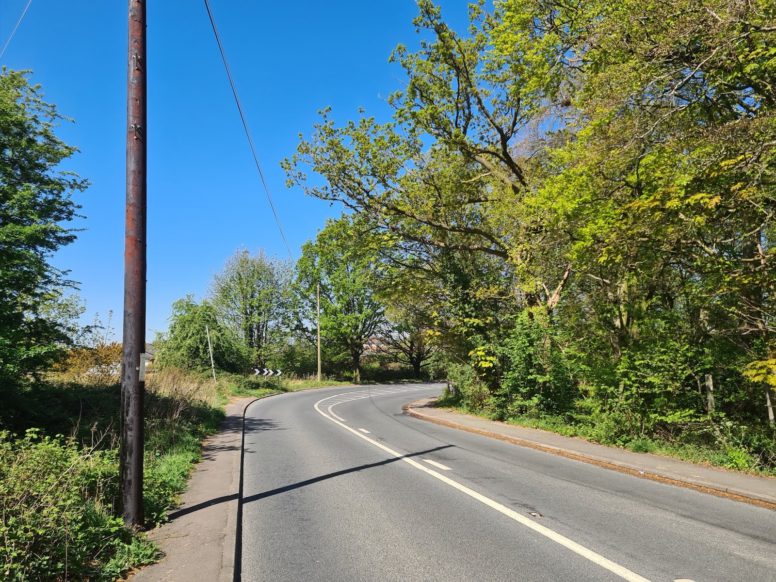
| The rare sight of Preston Road empty of traffic in the middle of the day, another consequence of lockdown |
A few years after the new section was opened, Whittle’s
first Church of England chapel was built beside it, and the National School
moved to a new building next to the vicarage. However, apart from these establishments and a
couple of inns (the Bay Horse and the Halfway House), the new road remained
remarkably undeveloped until the end of the 19th century, when J.N.
Boothman built rows of terraced houses for workers at his new Swansey Mill. The
road from Shaw Brow south to the Sea View inn remained undeveloped until after
World War Two, when “ribbon development” of middle-class houses reached all the
way along to Hartwood Green.
Dawson Lane
On 19th century Ordnance Survey maps, the legend
‘Site of Stone Cross’ appears by the side of Dawson Lane, on a bend near to the
western access road to Crook Hall (now Lisieux Hall). Wayside stone crosses were once numerous
in many parts of the country. They were erected between the 9th and
15th centuries and served as waymarkers and also as places of
comfort to the Catholic faithful. They were often found on routes with
religious associations. Following the reformation, most crosses were taken
down, but the stone pedestals on which they stood sometimes survived into the 19th
century.
The significance of the wayside cross on Dawson Lane is
twofold. Firstly, it confirms that it is an ancient road. Secondly, it
emphasises its main original purpose, which was to provide a route from Whittle
to the parish church at Leyland; indeed it can be followed all the way to that
church. In a thirteenth century document, it is referred to as ‘the kirkgate to
Leyland’. Generations of parishioners, and many hundreds of funeral
processions, would have passed by the cross, perhaps stopping to rest and to
offer up a prayer. We will encounter the site of another stone cross shortly.
Dawson Lane also provided access to the nearest thing that
Whittle had to a manor house, Crook Hall. ‘Old Crook’ was sited not far from
the stone cross and ‘New Crook’ (the present Lisieux Hall) was a quarter of a
mile to the east. As I discussed in my article on ‘The Stately Homes of
Whittle-le-Woods’, the route of Dawson Lane was almost certainly altered when
New Crook was built in the 17th century. It was pushed to the south
to extend the park in front of the new house, and to allow the construction of a fine drive from
the road to the house. Dawson Lane returns to its original route, which can
still be followed by taking a public footpath and the access road to Lisieux
Hall, after two precipitous right-angled bends, needed to keep the road away
from neighbours’ lands.
 |
| One of the right-angled bends that irritate motorists on Dawson Lane |
 |
| The modern course of Dawson Lane embraces a number of bends as it passes Crook Hall. It was apparently diverted when Crook Hall was built, to give the new house more land to its south side. The previous course of the road can be traced, via a footpath to the east of Crook Hall and an access road to the west. (Diagram taken from my article 'The Stately Homes of Whittle-le-Woods' |
 |
| The former route of the 'Kirkgate to Leyland' is now a public footpath |
Dawson Lane originally began in the east at Waterhouse
Green, but the construction in the 1820s of the new turnpike and Shaw Hill
Bridge means that it now starts from Preston Road. A public footpath from that
road down a flight of steps to Waterhouse Green acknowledges the original route
of Dawson Lane.
 |
| These steps mark the original route of Dawson Lane to Waterhouse Green |
Carwood Lane/Hilltop
Lane
The other stone cross in Whittle township was sited on
Chorley Old Road at its junction with Carwood Lane, and marked the beginning
of the old road from Whittle to the parish church at Brindle. Indeed, this
route can be seen as a continuation of Dawson Lane, linking Leyland and
Brindle. Today, Carwood Lane is a footpath, and was saved from dereliction
some twenty years ago by volunteers who restored it to something like its
appearance when it was an ancient packhorse road.
There were many lanes in medieval times and not all have become
modern roads. Lanes fell out of use for many reasons. In the early 19th
century, Carwood Lane was cut through by the Lancaster canal, the ensuing
diversion across the canal to Hilltop Lane adding about a third of a mile to
the route. The canal resulted in
the wharf at Rip Row becoming the main focus of the village and so traffic from
Brindle may have headed in that direction rather than along Carrwood Lane.
Also, Brindle itself was scarcely touched by industrialisation and became
something of a backwater. All these factors led to the decline of Carwood Lane.
 |
| Carwood Lane has been tastefully restored to something like its appearance when it was part of the packhorse road to Brindle |
Its northern counterpart, Hilltop Lane, is a classic country
road. Ascending a hill, it is in places a holloway,
the roadway sunken below the surrounding fields by centuries of erosion; rain
washing the former gravel surface down the hillside. At the bridge across the M61 it
enters Brindle parish and continues as Denham Lane to the parish church.
 |
| Hilltop Lane is in places a holloway, the road level sunk below the adjacent fields by centuries of erosion. The mature oaks on the right once formed part of an ancient hedge |
Town Lane
Town Lane is so named because it once gave access to
Whittle’s ‘Townfield’, an area of common arable land in which local farmers
could grow grain crops. The townfield was sited on the flattish land to the
north of Town Lane and remained common ground until the end of the 18th
century, when it was enclosed and let out to individual tenants. Town Lane was
also the road from Whittle to the neighbouring township of Heapey.
 |
| The former Townfield of Whittle, with Town Lane running behind it |
From the early 19th century, Town Lane was a hive
of activity. At its western end, off Waterhouse Green, was Lowe Mill Print
Works, many of whose workers lived in the row of cottages at the foot of the
Lane. A little further up was a small cotton spinning mill, which after its
closure became known as the Old Factory and accommodated handloom weavers and
mill workers. It was demolished in the 1880s. Along the ridge at the top of the
hill were up to five farms and smallholdings, and lanes led to more farms at
Lucas Green and Wilson’s Nook. From 1803, the Lancaster Canal cut through the
road and a wharf was built to load and unload goods, with a public house, the
Navigation Inn, to cater for the thirsty boatmen. In the second half of the
century a small brick works was sited beside the canal near Wilson’s Nook farm.
Continuing up Town Lane, there was a colony of handloom weavers near Johnson’s
Hillock, whose cottages later in the century housed mill workers, with their
own beerhouse, the British Lion. Finally, near the junction with the Chorley to
Blackburn Road (known at that point as Sandy Lane) was Whittle’s oldest church,
the Catholic St Chad’s, opened in 1791. Town Lane today is a picturesque and
relatively quiet residential road, with little remaining evidence of its busy
past.
 |
| The access road to Wilson's Nook farm does not have the status of a named road, but retains the feel of a country lane |
 |
| Town Lane, looking towards Lowe Farm |
Lucas Lane
Lucas Lane is today divided into east and west sections, and
they are different in character. Lucas Lane West (from Town Lane to Lucas
Green) is the best example of an ancient lane in Whittle; narrow, winding and
lined by mature trees and hedgerows, or drystone walls. It originally provided access from
Crostons farm to the Townfield and it retains its character despite the
encroaching housing estates that may eventually surround it. By the way, I will
not be hypocritical or nimbyish about the amount of new building in Whittle. I
myself live on a modern estate on the site of a 19th century farm,
and I don’t see why others shouldn’t have the opportunity to live in such an
agreeable area. Britain needs many more houses and with proper planning,
Whittle can do its bit to supply them while maintaining its semi-rural feel.
 |
| Old meets new on Lucas Lane (West), with the remains of an ancient drystone wall looked over by new housing |
Lucas Lane East (from Lucas Green to Preston Road), by
contrast, has a different appearance. It is wider and dead straight, with
spacious verges. It is depicted like this on 19th century maps,
but it is undoubtedly an ancient lane. It seems that it was ‘improved’ in the
late 18th or early 19th century, but why?
 |
| Lucas Lane (West) is as narrow and winding as a country lane should be... |
 |
| ...while Lucas Lane (East) is wider and dead straight, following early 19th century improvements |
The answer lies in drainage. The fields that used to
surround this section of the lane all had names including ‘Moss’, signifying
that the land was once marshy. Lucas Lane East includes field drains on its
course. It appears that at some point, drains were dug to make land more
suitable for farming, and at the same time, the lane was rebuilt and
straightened to parallel the drain. Today, the fields are covered by houses,
their occupants presumably unaware that they are living on a former marsh.
Which brings us to…
Moss Lane
This lane runs along the relatively flat south end of the
township, bordering the former marshland of Gale Moss. It is not the township’s
southern boundary; that honour goes to an ancient hedge that runs parallel to
Moss Lane from the Sea View pub. Moss Lane provided access to a number of farms
and linked the Chorley/Preston and Chorley/Blackburn roads. Today it is the
B6229 and is cut through by the M61, and as such retains little of its former character,
but it still follows its ancient winding route, that presumably reflected the
need to avoid patches of marshland.
 |
| Lockdown has even quietened the M61, seen here from Moss Lane |
Dark Lane/Copthurst
Lane/Birchin Lane
These lanes together form a route through the hilly eastern
half of the township, from Moss Lane in the south-east to Chorley Old Road in
the north-west. Dark Lane was known in the 19th century as Lower
Lane. In the 1830s, a chalybeate spring was discovered nearby, leading to the
establishment on the lane of a spa (Heyes Hotel, later the Howard Arms) and
Whittle Springs brewery. Both had ceased to function by the 1920s. Copthurst
Lane is the highest road in the township, originally serving Higher Copthurst Farm
before crossing the Leeds-Liverpool canal and plunging down Copthurst Brow, past
the ruins of Denham Springs Print Works, to cross the river Lostock at Denham
Springs farm. The steep gradient has allowed Whittle’s deepest holloway to
develop. The bridge across the Lostock may well be a former packhorse bridge,
with low side walls to avoid obstructing the horses’ panniers.
 |
| Lockdown may be boosting the displays of wild flowers on roadside verges. This is Copthurst Lane |
 |
| The steep gradient of Copthurst Brow has made it into Whittle's deepest holloway |
 |
| The bridge across the Lostock at Denham Springs may be a former packhorse bridge, with low side walls to avaoid obstructing the horses' panniers |
The route then ascends another hill as Birchin Lane. This lane is also the township boundary, emphasising that it is an ancient routeway. Township boundaries were drawn up in late Saxon times and in places followed existing roads. Birchin Lane's antiquity is reinforced by the presence of the ancient woodland of Denham
Wood on its eastern side.
 |
| Birchin Lane is the boundary between Whittle and Brindle townships. Denham Wood, on the right of the picture, is ancient woodland; the wood on the left dates from the 1970s |
After crossing Denham Lane (and the M61 motorway), Birchin
Lane swings west towards Chorley Old Road. It passes between two old abandoned
quarries, then the site of St. Helen’s well and finally the site of St.
Helen’s chemical works. Its junction with Chorley Old Road was cut off by the
Lancaster canal, so it turns south along a residential road that was once known
as Barracks Street. It was supposedly the site of a camp for French Napoleonic
War prisoners, conscripted to build the canal. In the 19th century,
Barracks Street was part of the rowdy mix of handloom weavers, mill workers,
boatmen and quarrymen that made up the little community of Rip Row.
Mill Lane &
Swansey Lane
On the face of it, our final lanes are unlikely candidates
for ancient routeways. Mill Lane today runs from Rip Row down the hill to
Preston Road. Its top section curves round the former canal basin and is lined
with post-war houses, indistinguishable from the adjacent housing estates. It then runs dead
straight past Swansey Mill, suggesting a Victorian origin. But appearances can
be deceptive. Look across Preston Road from the bottom of Mill Lane, and you
will see, through a jumble of houses, Back Lane ascending a hill and heading
into Clayton-le-Woods. Prior to the construction of the 'new' turnpike, Mill Lane joined
onto Back Lane. This provided a packhorse route from Rip Row to the former
community of Clayton Town, at the foot of Sheep Hill Brow, where there was a corn mill that flourished until well into the 19th
century. So Mill Lane is indeed an ancient routeway. And so is Swansey Lane, which
was once the continuation of Birchin Lane and also connected with Back Lane. It
carries the boundary between Whittle and Clayton-le-Woods and also hosts
Swansey farm, which in the 17th century was the second largest
dwelling in Whittle, after Crook Hall.
So there we have it. This completes my trip around the
ancient highways of Whittle-le-Woods. I hope it will encourage you to explore
these fine lanes yourselves, if you do not do so already. You may well meet me
on my daily walk. But if you do so while social distancing is still in place, I
will probably cross the road to avoid you.
Postscript: Sandy Lane/Blackburn Road
After completing and publishing this article, I realised that I had left out one of Whittle's ancient roads, albeit one that is within the township boundaries for just a quarter of a mile. This is the road from the north of Chorley to Blackburn, via Botany Bay and Wheelton. The section in Whittle, now named Blackburn Road, runs from just south of Moss Lane to the junction with Town Lane. Old maps show the site of a stone cross near Moss Lane, signifying an ancient route, and the road appear on 18th century maps. In 1843 the route became the Chorley to Finnington Bar turnpike, the last turnpike to be created in Lancashire. This improvement made the establishment of a mill in Wheelton more viable, leading to the growth of that village. The short section in Whittle is not without interest. In the 19th century it was known as Sandy Lane, and was flanked by weavers' cottages. Near to Town Lane was the Red Cat inn, that dated from the 18th century and is still (pre-pandemic) a thriving restaurant. To the south was Gorse Hall, a 19th century gentleman's residence that was demolished in 1970. In the early 1970s, the new A674 was built, running from Junction 8 on the M61, crossing the old turnpike near Moss Lane and bypassing Wheelton. Sandy Lane, by now Blackburn Road, became a relatively quiet B-road, flanked by housing estates.
Sources
Used
Tithe maps available at
Lancashire Archive, Preston.
Hodgkinson K (1991) Whittle & Clayton-le-Woods: A Pictorial
Record of Bygone Days. Chorley: CKD Publications.
Muir R (2000) The New Reading the Landscape. Exeter: Exeter University Press
Rackham O (2003) The Illustrated History of the Countryside. London: Weidenfeld & Nicholson
Muir R (2000) The New Reading the Landscape. Exeter: Exeter University Press
Rackham O (2003) The Illustrated History of the Countryside. London: Weidenfeld & Nicholson
Winchester A (2006) England’s Landscape: The North West.
London: Collins (English Heritage).
Whittle-le-Woods
Community Hall (2006) Whittle Walks:
Exploring the heritage of Whittle-le-Woods, Lancashire.


